Introduction: Front Page
LCAMS at a Glance
The enhanced front page on LCAMS allows the user to view regional closures. No user account is required to view this page.
The primary features of this page allow the viewer to "zoom" into areas of interest, view detailed lane closure information, and filter closures by date. Map layers may be switched to provide different views such as satellite or topographical imagery. Navigation is mouse-driven: double-clicking in an area will incrementally increase the zoom level, the map can be dragged by clicking and holding the left-mouse button, and navigation controls are provided for an additional level of control.
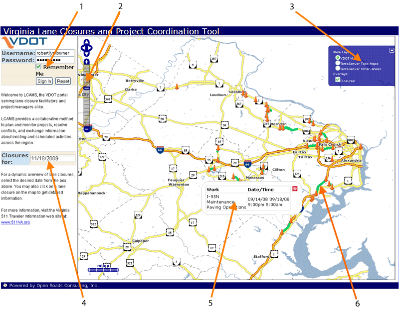
- Login - Enter username and password to sign in. Selecting <Remember Me> will auto-fill the username the next time the application is launched
- Navigation Bar - Click a selection to access different functional areas
- Layer Control Panel - Activate this control to enable different visual layers such as an top-down perspective that provides a birds eye view
- Date Filter -
Select a date from the drop-down calendar to display scheduled closures on a specified date
- Pop-up Window - To show detailed information, click on a lane closure to display the informational pop-up window
- Lane Closure - Closures are indicated by a mapped line segment with orange-colored cones marking the endpoints


