


LCAMS is built around the ability to quickly add and modify lane closures as well as determining if a lane closure conflicts with an existing entry. This chapter will demonstrate the ability of the system to accept new lane closure advisories, modifications to existing lane closures, and visually determine potential conflicts. Clicking on the <Add Closure> option on the on main navigational bar will begin the operation of scheduling a new lane closure.
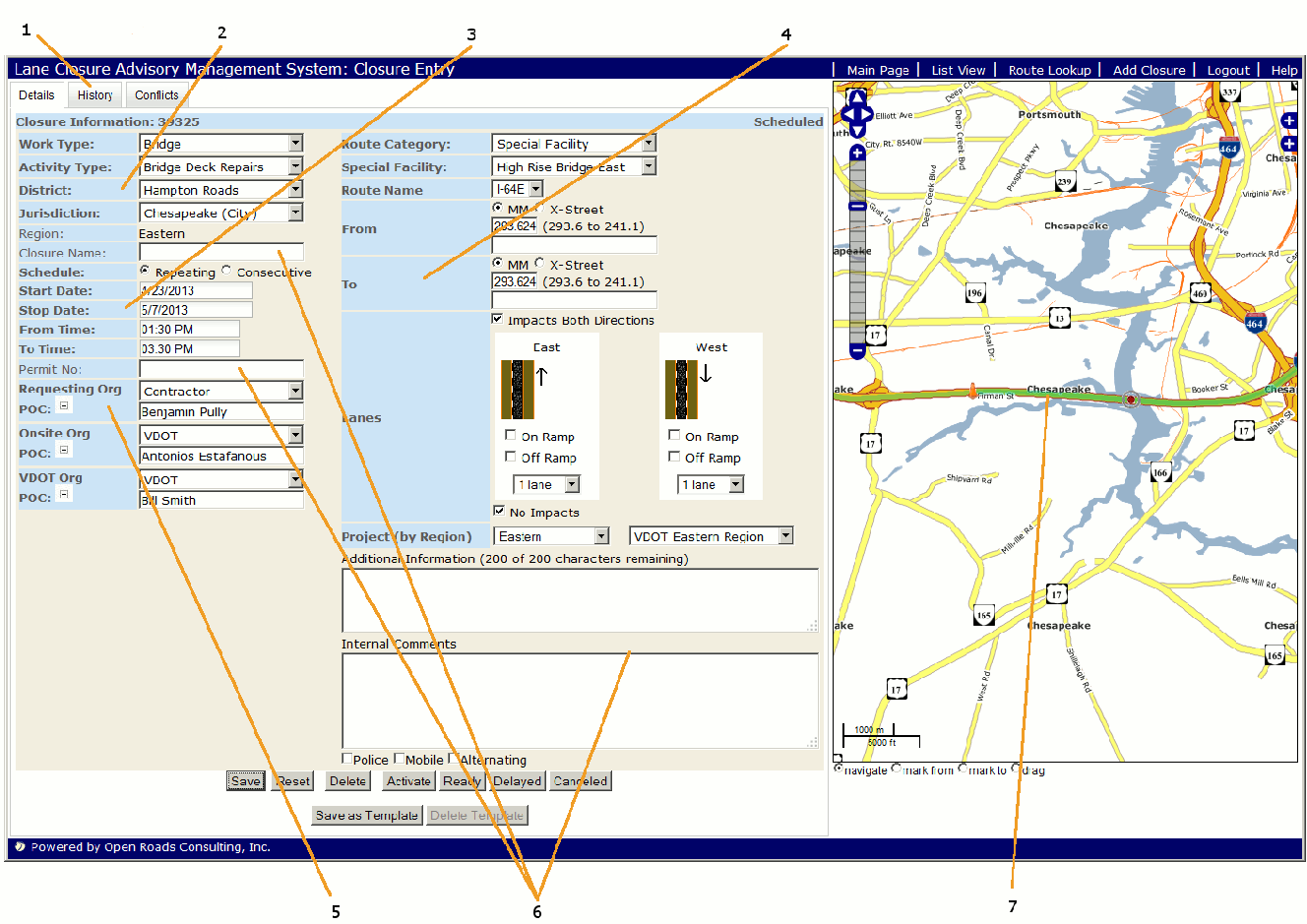
The "Add Closure" entry page is divided into several sections each of which will be explained in detail. The data entry area on the left side of the window is for detailed entry and the graphical region on the right side of the window which provides a graphical representation of the closure as well as existing lane closures in the system. Data entry is intended to flow sequentially from top-left to bottom right. The reason for this is due to dependency in that available choices in "Route Name" will changed based on the selection made in "Route Category" located directly above the field. Field names highlighted in bold font are required fields.
![]()